Written by Andy Meier, U.S. Army Corps of Engineers
Two hundred years ago this year, Giacommo Beltrami, an Italian adventurer, rode the steamboat Virginia from St. Louis to Fort St. Anthony, now Fort Snelling in the Twin Cities, on a quest to find the source of the Mississippi River. The Virginia was the first steamboat to successfully navigate the Mississippi River to Fort St. Anthony, and Beltrami noted as he traveled how the river looked at that time: "Little islands, studded with clumps of trees, among which the steamboat was winding its course, appeared like most enchanting gardens.” In many places on the Upper Mississippi River today, you can still find these places, paddling through backwaters on a kayak or running up back sloughs with a fishing boat, the tree covered islands remain enchanting. A lot has also changed since Beltrami made that voyage in 1823. Most people who use the river today are accustomed to seeing large areas of open water, consistent river depths throughout the summer, and expansive floodplain marshes. When the Virginia entered the south end of Lake Pepin with Beltrami onboard in 1823, which he said was like entering “the amphiteatres of antiquity,” it would have been the first time for hundreds of miles in which he saw open water. The Upper Mississippi River of 1823 was made up primarily of isolated backwater lakes with scattered marshes and extensive floodplain forests. Water levels naturally dropped during the summer months meaning that even many areas on the main river channel were shallow enough to wade across. Shifting sandbars made navigation difficult.
The first changes came with settlement of the river valley and floodplain by Europeans in the mid- to late-1800s. Settlers were hungry for land to farm, and many areas in the floodplain were cleared for agriculture, even if only for the production of marsh hay and cattle pasture. Until the 1860s, steamboat traffic on the Upper Mississippi was primarily fueled by wood, so further cutting of forest almost certainly occurred to fuel those steamboats, which would stop periodically along the river to “wood up” at locations where an enterprising local had piled cordwood to sell to the steamboats. Higher elevation areas were cleared for homes and cities. Many of today’s Upper Mississippi river towns occur in places that were once forests or prairies.
From time immemorial the Upper Mississippi has been used for transportation, with Native people active within the floodplain as far back as 12,000 years ago. But the need for a reliable channel for navigation brought about the next big change in the river in the 1930s with the building of the Locks and Dams as part of the 9-Foot Channel Project. The 9-Foot Channel Project was authorized by Congress to ensure reliable transportation of goods on the Upper Mississippi between St. Louis and St. Paul, and relied on the establishment of Locks and Dams to elevate water levels between each dam enough that a 9-foot depth could be maintained in the main river channel. The dams and upstream pools were designed to provide those minimum water levels throughout the year, enabling river navigation at any time that the river was ice free. The 9-foot Channel continues to function today and more than 90 million tons of commerce is moved within the project every year.

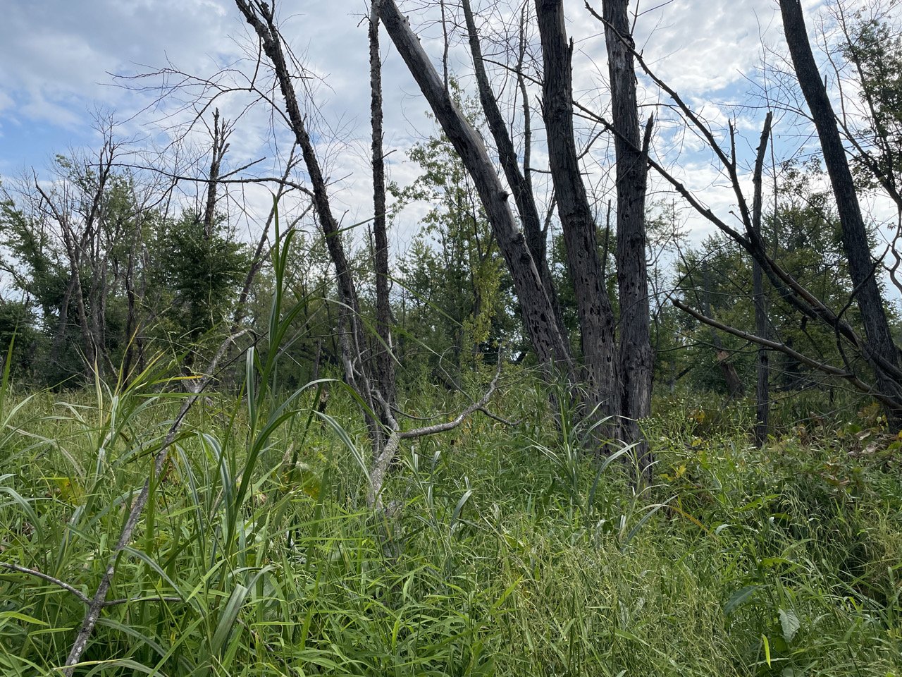
Typical forest condition at intermediate elevations in Pool 4 – large trees with open canopy gaps dominated by herbaceous vegetation. Almost all of the small trees in this photo are green ash, which will be killed by Dutch elm disease.
However, installation of the Locks and Dams also brought about ecological changes in the Upper Mississippi. What had once been a free flowing river, subject to high and low water periods based on precipitation trends within the larger watershed, is now a river constrained in a series of stabilized pools, with minimum water levels in these pools maintained throughout the year. (It’s worth noting that the pools were not designed to hold back high water, so in periods of high water, the river is able to return to a largely free flowing state as water flows over the dams.) The impacts of this permanent inundation on river habitats were evident within a few years of completion of the dams. Within four or five years, large areas of forest that had been flooded had converted to open marsh habitats, and many areas of historic marsh had converted to open water conditions. Conservationists at the time, though, actually appear to have largely viewed this expansion of marsh and open water habitat as a good thing because it allowed for an expansion of habitat available for fish and waterfowl. At that time, forest habitat appears to have been considered as less valuable for wildlife than marsh and aquatic vegetation.
It's easy to think that changes in forests were locked in place with the building of the dams, but we are currently in a third phase of forest change on the Upper Mississippi, one driven much more by changes in precipitation patterns and land use in the watershed. Over the last few decades, the watershed that supplies water into the Mississippi River has experienced an increasing trend in annual precipitation, and part of that change in precipitation is associated with a substantial increase in the number of very large rain events. The larger watershed outside of the river floodplain that Beltrami moved through in 1823 was dominated by prairies and woodlands, with large areas of wetlands scattered throughout. All of these habitats have the ability to capture water in the soil, slowing the flow of water into rivers. With agricultural and urban development, however, areas that were once able to absorb rain and reduce runoff into tributary rivers have become less and less permeable, with rainwater in many areas running off rapidly into streams and rivers. As a result of both of these factors, the Upper Mississippi River has seen a trend of generally increasing river flows (with some drier years mixed in) over the last few decades. What this has meant for remaining forests in the Upper Mississippi has been a continued but slow loss of forest at the edges of areas that have become increasingly wet and are now no longer dry enough to support the growth of trees. If the upward trend in river flows continues, it’s likely that forest loss will continue to occur over the next decades as areas become less suitable for forest.
But even with all these changes, the Mississippi River floodplain forests that remain are amazing places. Floodplain soils are high in nutrients and moisture, key ingredients for trees to grow fast and large. Many of the trees that grow in the floodplain have timed the dissemination of their seed for early summer, a time that conveniently corresponds with the time of the year when spring floods have usually dissipated and aggressive competition from grasses and other weeds is suppressed by newly deposited sediment. Many floodplain tree species produce tiny seeds, thousands upon thousands of them, that get caught in the wind and carried in every direction. Cottonwoods are some of the fastest growing trees on the river, but they start out as a tiny seed with a parachute of fluff attached to help them float through the air. The vast majority of the seeds just float away and land somewhere that’s not suitable for trees to grow, but when those tiny seeds land on moist, fresh sediment, they germinate, put down roots and grow. And they grow FAST! Young cottonwoods can grow to over five feet tall in just two years, and by the time they reach their hundredth birthday, they can tower over that forest at ninety feet or more. Outside of some old growth forests in wilderness areas in the Upper Midwest, the floodplains of the Upper Mississippi boast some of highest concentrations of big trees in the region. While trees 40 inches in diameter (that’s just over 10 feet around the trunk) are rare in most midwestern forests, it’s rare on the river to walk a day in the woods and not run into a dozen or so of them, and sometimes many more. And if you could dig down around the bottom of a big old silver maple tree, you might find the base of the tree four or five feet down, buried under a century’s accumulation of sediment.
The forests in Pool 4 are reflective of forests throughout the northernmost stretch of the navigable portion of the Mississippi River. Like in most other pools, large areas of forest have been lost since the 1800s, with much of the area converted to marsh or aquatic habitat, though large areas of contiguous forest still remain. The Nelson-Trevino Bottoms and the Tiffany Bottoms complex comprises one of the largest contiguous patches of floodplain forest in the upper river and, given the difficulty of accessing the interior of these areas, there are many places that have likely seen very little human activity over the last century. These large areas of contiguous forest are critical habitat for dozens of wildlife species. The prothonotary warbler is a little bright yellow bird that lives almost exclusively in wet forests dominated by silver maple. If there’s not water around, you won’t find a prothonotary warbler. And these little birds are completely dependent on floodplain trees for their survival – they are the only species of warbler in the eastern United States that use tree cavities for nesting. Without trees in the floodplain, birds like the prothonotary warbler would disappear from the landscape.

Naturally regenerated swamp white oak seedling near Indian Slough, Pool 4.
Floodplain trees are tough, and there are places in Pool 4 where forests are healthy and thriving. But overall, the long-term prognosis for the remaining acres of floodplain forest is not good. In most areas, there are no young trees growing under the existing forest to replace the older ones when they die. Variable and unpredictable flooding over the last few decades has meant that areas of forest that were historically stable are now becoming much more vulnerable. And the impact of exotic insects, like the emerald ash borer, or diseases, like Dutch elm disease, will continue to be felt for centuries – elm and ash are the two most common species that are found growing as young seedlings under existing forest canopies and the loss of those tree species as canopy trees further accelerates the transition of current forests to marsh or other habitats.
With all that in mind, management and rehabilitation of forests in Pool 4 and throughout the Upper Mississippi River is critical. Management of large river habitats often focuses on aquatic areas, but in the Upper Mississippi, the long-term health of floodplain forests have become a top priority for agencies with responsibility for management of this invaluable ecosystem. Some floodplain forest management is being conducted using dedicated annual budget funding for environmental management. As an example, the US Army Corps of Engineers St. Paul District has foresters on staff on the River who are responsible for utilizing budget funding for Environmental Stewardship to conduct forest management on Corps-owned land within the river floodplain, and management on numerous sites in Pool 4 has focused on control of invasive species and establishment of young trees. The US Fish and Wildlife Service has put a significant emphasis on assessment of the conditions of the forests on Refuge lands in Pool 4 and has identified numerous areas in need of rehabilitation. Additional exciting opportunities are also on the horizon. The Upper Mississippi River Restoration Program, a partnership between the Corps, the US Fish and Wildlife Service, and Departments of Natural Resources from Minnesota, Wisconsin, Iowa, Illinois and Missouri, is in the process of developing a series of large projects in the lower end of Pool 4 that will incorporate improvement in both aquatic and forest habitat, including creation of higher elevation areas to establish young forest on and management of hundreds of acres of currently forested areas that could benefit from tree planting and other management actions. Other major funding sources leveraging federal and state partnership along with the key advocacy of the Lake Pepin Legacy Alliance, have enabled the development of another large project near Bay City, Wisconsin in Upper Pool 4 which also includes creation and enhancement of forest habitat alongside aquatic habitat improvements.
Two centuries have passed since Giacomo Beltrami boarded the first steamboat to travel to St. Anthony Falls, and it’s unlikely that he’d recognize it as the same river. Settlement and development of the river floodplain, channel improvements for navigation, and increasing variability in climate have all brought about drastic changes to the river and shifts in the habitats that the river supports. The extensive floodplain forests he saw still remain, but the patches are smaller and the health of them is poorer. We can only wonder what these forests will look like two centuries from now, but the opportunities today to actively manage and improve those habitats to ensure that there will still be forests on the floodplain in 2223 are opportunities that we can’t pass up.